Athena Review Image Archive ™
Provence: Map of Roman sites in the Lower Rh¶ne Valley
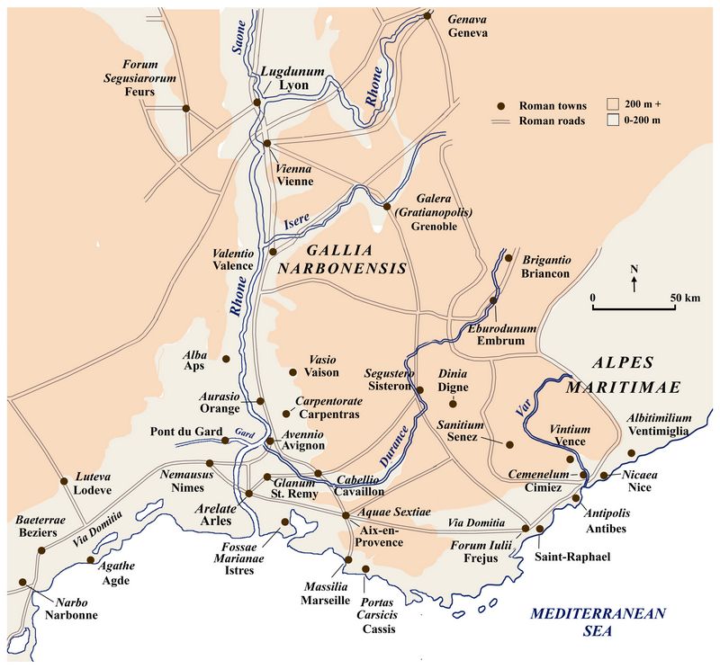
Map of Roman sites in the lower Rh¶ne Valley (Athena Review Image Archive)
Many
Roman towns began as colonias for
legionary veterans, built at former Gallic settlements which already
served as market towns. The Rhone River served as a major artery
of boat traffic, and was crossed or flanked by several major
Roman roads (shown as gray-brown lines),
These included a
north-south route from Marseille (Massalia) to Cologne (Colonia
Agrippinensis) on the Rhine river, and another from Paris (Lutetia) to
the Alps near
Briancon. Along the Mediterranean coast, a major route was the Via
Domitia. These routes are known from the 2nd century AD Antonine Itinerary and 3rd century AD Peutinger Table.
Upland
areas (over 200 meters elevation) are shown as light red in the map,
contrasting to river bottomland areas in light gray where most roads and
settlements are located.
.Copyright ® 1996-2019 Rust Family Foundation (All Rights Reserved).