Athena Review Image Archive ™
Vienne: Map of the Lower Rh¶ne Valley
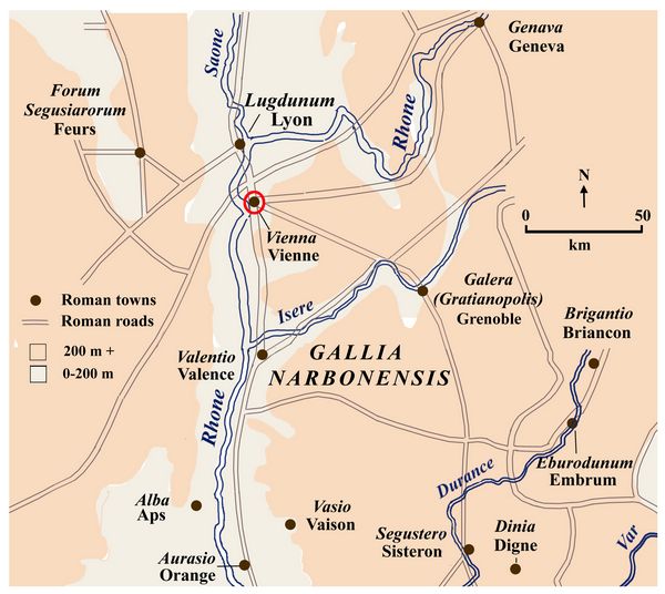
Map of the lower Rh¶ne Valley (Athena Review).
Vienne
(Roman Vienna) grew along both sides of the Rh¶ne River in the 1st-4th
centuries AD. Like many Roman towns, Vienne started as a colonia for
legionary veterans, built at a former Gallic settlement, the capital of
the Allobroges tribe. After 52 BC it also served as a supply depot for
the Roman legions.
Located at the crossing of the Rh¶ne by
several Roman roads (shown as gray-brown lines), Vienne became a major
riverine trading port by the end of the 1st century AD, and remained
prosperous through the 4th century.
Major Roman roads included a
north-south route from Marseille (Massalia) to Cologne (Colonia
Agrippinensis), and another from Paris (Lutetia) to the Alps near
Briancon. These routes are known from the 2nd century AD Antonine Itinerary and 3rd century AD Peutinger Table.
Upland
areas (over 200 meters elevation) are shown as light red in the map,
contrasting to river bottomland areas in light gray where most roads and
settlements are located.
.
Copyright ® 1996-2019 Rust Family Foundation (All Rights Reserved).