Athena Review Image Archive ™
Map of the Gulf of Mexico from Cortťs Expedition (1524)
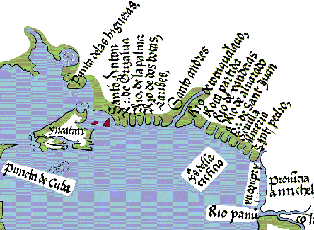
1524 map of the Gulf of Mexico from the Cortťs voyage (after Winsor 1885).
This
1524 map of the Gulf of Mexico was made shortly after the Cortťs voyage
of 1519-21, using information it provided. The map's orientation has
the south at top. In this section, the western tip of Cuba ("puncta de
Cuba," at Cabo San Antonio) is at left, and the RŪo Panuco (in
Veracruz) is at right.
YucatŠn is depicted inaccurately as
an island, and the Laguna de Terminos as a strait (seen by two small
red islands). The map, however, also contains much valuable new
information on rivers. In another map section representing the northern
part of the Gulf of Mexico (not shown here), the Mississippi River is
mapped for the first time, and Florida is correctly shown as a
peninsula, based on the findings of Ponce de Leon.
Copyright © 1996-2019 Rust Family Foundation (All Rights Reserved).