free trial issue subscribe back issues
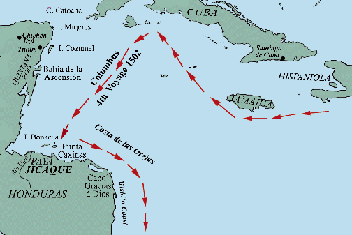
The first likely contact between the Spanish and Maya (or their neighbors in Honduras to the east) occurred in the 1502 voyage of Christopher Columbus between Hispaniola and the Darién peninsula of Panama. During a brief stopover at Bonacca (then called Guanaja) in the Bay Islands on the Honduran coast (fig.1), the Spaniards met a large seagoing canoe, similar to Antillean pirogues seen in Columbus' First and Second Voyages and to others now known from murals at Chichén Itzá (fig.2).
[Fig.1: Map showing the route of Columbus's 4th Voyage in 1502 from Hispaniola to the coast of Honduras.]
As Fernando relates, "Having come to the island of Guanaja, the Admiral sent ashore his brother Bartholomew, with two boats. They encountered people who resembled those of the other islands, but had narrower foreheads. They also saw many pine trees and pieces of earth called cálcide which the Indians use to cast copper; some of the sailors thought it was gold....by good fortune there arrived at that time a canoe long as a galley and eight feet wide, made of a single tree trunk like the other Indian canoes; it was freighted with merchandise from the western regions around New Spain. Amidships it had a palm-leaf awning like that on Venetian gondolas; this gave complete protection against the rain and waves. Underneath were women and children, and all the baggage and merchandise. There were twenty-five paddlers aboard, but they offered no resistance when our boats drew up to them."
 The large canoe
was loaded with trade goods, the "costliest and handsomest" of which were
"cotton mantles and sleeveless shirts embroidered and painted in different
designs and colors (fig.3); long wooden swords edged with "flint knives that
cut like steel" [perhaps obsidian]; copper hatchets and bells; and a crucible
for melting copper. Notably, they also had:
The large canoe
was loaded with trade goods, the "costliest and handsomest" of which were
"cotton mantles and sleeveless shirts embroidered and painted in different
designs and colors (fig.3); long wooden swords edged with "flint knives that
cut like steel" [perhaps obsidian]; copper hatchets and bells; and a crucible
for melting copper. Notably, they also had:
"...many of the almonds [cacao beans] which the Indians of New Spain use as currency; and these the Indians in the canoe valued greatly, for I noticed that when they were brought aboard with the other goods, and some fell to the floor, all the Indians stooped to pick them up as if they had lost something of great value..."(Colón 1959)
[Fig.2: Drawing of wall mural from the Temple of the Warriors at Chichén Itzá, showing Toltecs passing the Maya coast.]
Impressed with "the great wealth, civilization, and industry of these people,"
Columbus nevertheless continued east in search
 of "a strait
across the mainland that would open a way to the South Sea and the Lands
of Spices." Columbus did retain from the canoe an older man and cacique named
Yumbé, "who seemed to be the wisest man among them and of greatest
authority," as an interpreter. Sailing east along the coast,
of "a strait
across the mainland that would open a way to the South Sea and the Lands
of Spices." Columbus did retain from the canoe an older man and cacique named
Yumbé, "who seemed to be the wisest man among them and of greatest
authority," as an interpreter. Sailing east along the coast,
[Fig.3: Mayan cloth from Jaina (Museo Nacional de Mexico; photo Athena Review)]
"The Indians in the vicinity of Point Caxinas were dressed like those in the canoe, in dyed shirts and breechclouts; they also had thick quilted cotton jerkins like breastplates that were sufficient protection against their darts and even withstood some blows from our swords. But the people who live farther east, as far as Cape Gracias á Dios, are almost black in color, ugly in aspect, wear no clothes, and are very wild in all respects. According to the Indian who was our prisoner they eat human flesh and raw fish, and pierce holes in their ears large enough to insert hen's eggs; that is why the Admiral named that country Costa de las Orejas [Coast of the Ears]. Eventually, reaching the limits of territory where Yumbe's language was spoken, "the Admiral gave Yumbé some presents and sent him home very satisfied. This happened before we reached Cape Gracias á Dios, on the Costa de las Orejas." (Colón 1959)
Regarding possible cultural identification of Yumbé and his companions in the trading canoe, the Bay Islands were east of the Maya region. Along the the Honduras coast were spoken Jicaque and Payan languages, the latter used in the Bay Islands, and both distinct from the Maya language family whose over 30 dialects stretch from Tabasco to the Ulúa River. Bartholomew Columbus, the brother of Christopher, wrote in 1506 that the canoe had come from "a certain province called Maian." Morison (1942), however, notes this was a name used by the Jicaque Indians for this portion of north Honduras, and did not stand for the Maya. Further east, around Cabo Gracias á Dios (named by grateful Spaniards after weeks of tacking against prevailing winds), other cultures and languages were encountered, including Mam, and Misumalpan languages now grouped as Miskito.
Archaeologically, the eastern boundary of Maya stone architecture and pottery types is at the Ulúa river and Lake Yojoa, where sites at Playa de las Muertos show a mixture of Maya, Jicaque and Paya traits. A number of large, complex sites with mounds, many not yet excavated, are in the Costa de las Orejas region and at Palo Grande on Bonacca. While the traders encountered in the large canoe may well have been Mayan, Fernando Colon's unique historical contribution lay in his description of the otherwise virtually unknown cultural and geographical terrain which, in ca. 1500, extended from the Jicaque and Paya region to the coastal lands of the Mam and Miskito tribes.
Athena Review Image Archive™ | Paleoanthropology in the News | Guide to Archaeology on the Internet | Free issue | Back issues
Main index of Athena
Review |
Subject Index
| Travel
Pages |
Galleries and
Museums |
Copyright © 1996-2001 Athena Publications, Inc. (All Rights Reserved).